


Manuscript Collection
South Carolina Map Collection - Accession 786 - M360 (411)
Files
Identifier
Accession 786 - M360 (411)
Inclusive Dates
circa. 1970s-1980s
Restrictions
Open under the rules and regulations of the Louise Pettus Archives and Special Collections
Collection Size
5 pieces
Language
English
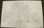
Scope and Content Note
The South Carolina Map Collection consists of a series of road maps produced some time in the 1970s or 1980s of different South Carolina regions, including the Upper Savannah region, Low Country region, Central Midlands region, Santee Wateree region, and the Catawba region.
Provenance
The South Carolina Maps collection was transferred from the Documents Department, Dacus Library.
Copyright
For information concerning copyright please contact the Louise Pettus Archives and Special Collections at Winthrop University.
Finding Aid Citation
Louise Pettus Archives and Special Collections, Winthrop University, "South Carolina Map Collection - Accession 786 - M360 (411)". Finding Aid 573.
https://digitalcommons.winthrop.edu/manuscriptcollection_findingaids/573
LC Subject Headings
Roads--South Carolina--Maps; South Carolina--Maps