


Manuscript Collection
A Map Of Carolina, Florida And The Bahama Islands With The Adjacent Parts - Accession 503 - M211 (253)
Files
Identifier
Accession 503 - M211 (253)
Inclusive Dates
ca. 1730s
Restrictions
Open under the rules and regulations of the Louise Pettus Archives and Special Collections
Collection Size
1 piece(matted)
Language
English
Scope and Content Note
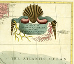
The map titled Map Of Carolina, Florida And The Bahama Islands With The Adjacent Parts consists of a view of the southeastern United States, the Bahamas, Cuba, Puerto Rico, Hispaniola, Cuba, and Yucatan Peninsula. This original color map, 20” x 26 ½” drawn by British Citizen Mark Catesby around 1733.
Provenance
A map of Carolina, Florida and the Bahama Island with the Adjacent Parts was given as a gift to the Archives on April 29, 1983 delivered by John Roper.
Copyright
For information concerning copyright please contact the Louise Pettus Archives and Special Collections at Winthrop University.
Finding Aid Citation
Louise Pettus Archives and Special Collections, Winthrop University, "A Map Of Carolina, Florida And The Bahama Islands With The Adjacent Parts - Accession 503 - M211 (253)". Finding Aid 437.
https://digitalcommons.winthrop.edu/manuscriptcollection_findingaids/437
LC Subject Headings
Southern States--Maps--Early works to 1800; Caribbean Area--Maps--Early works to 1800