


Manuscript Collection
Map of American Southeast 1775 - Accession 894 - M408 (459)
Files
Identifier
Accession 894 - M408 (459)
Inclusive Dates
ca 1996
Restrictions
Open under the rules and regulations of the Louise Pettus Archives and Special Collections
Collection Size
1 piece
Language
English;
Scope and Content Note
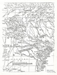
This collection consists of a photocopy of a map of the Southeast of America in 1775. The map shows parts of Georgia, South Carolina, and North Carolina.
Provenance
The Map of the Southeast 1775 was deposit in the Archives on February 23, 1996 by Pat Ballard.
Copyright
For information concerning copyright please contact the Louise Pettus Archives and Special Collections at Winthrop University.
Finding Aid Citation
Louise Pettus Archives and Special Collections, Winthrop University, "Map of American Southeast 1775 - Accession 894 - M408 (459)". Finding Aid 624.
https://digitalcommons.winthrop.edu/manuscriptcollection_findingaids/624
LC Subject Headings
Southern States--Maps